 |
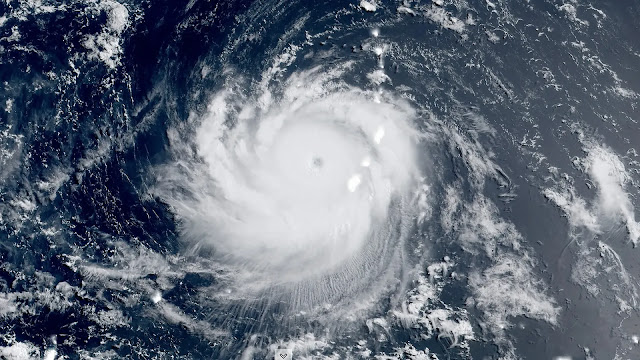
| Image (Axios.com) |
Super Typhoon Mawar is currently making its way towards the Philippine area of responsibility (PAR), and it is predicted to intensify further in the next 24 to 36 hours, according to the state weather bureau, PAGASA. This article will provide an overview of the expected development and impacts of Super Typhoon Mawar, as well as the potential risks it poses to the affected regions. It is crucial for residents and authorities to stay informed and take necessary precautions to mitigate the potential consequences of this powerful storm.
The Track of Super Typhoon Mawar:
As of the late Thursday evening weather advisory issued by PAGASA, Super Typhoon Mawar is anticipated to accelerate as it approaches the Philippine area of responsibility. The tropical cyclone is expected to enter PAR by Friday evening or Saturday morning. Following its entry into the region, Mawar is projected to slow down by Saturday.
Intensification and Peak Strength:
While Super Typhoon Mawar may experience a slight weakening on Saturday, it is expected to remain a super typhoon until Sunday or early Monday due to highly favorable environmental conditions. These conditions include warm sea surface temperatures and low wind shear. However, starting from Monday or Tuesday, the typhoon is likely to weaken at a slightly faster rate due to the occurrence of unfavorable conditions, such as increasing wind shear, cooler sea surface temperatures resulting from its slowdown, and the intrusion of dry air.
Impacts on Northern Luzon:
PAGASA has issued warnings to residents of northern Luzon to be prepared for heavy rains, which may lead to flooding or landslides, beginning late Sunday or on Monday next week. Extreme northern Luzon can expect strong to storm-force conditions, while the northern and eastern portions of the northern Luzon mainland may experience strong to gale-force conditions. As a precautionary measure, Wind Signals will be hoisted by Saturday in anticipation of these severe winds.
Enhancement of Southwest Monsoon:
Super Typhoon Mawar is also expected to enhance the southwest monsoon or habagat, resulting in rainy weather over large areas of the country by early next week. The combined effects of the typhoon and the enhanced monsoon can lead to widespread precipitation, posing additional risks of flooding and potential disruption of daily activities.
Precautions and Preparedness:
Given the potential impacts of Super Typhoon Mawar, it is essential for residents and local authorities to take necessary precautions and make appropriate preparations
Preparing for Super Typhoon Mawar: Essential Safety Measures


No comments:
Post a Comment